
Services
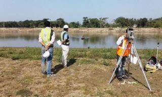
Land Survey Team got the approval from Surveyor General of Bangladesh in 1999 to provides guidelines on the requirements of survey, use of Serial Photography, Satellite Imaging, medium to large scale topographic maps, leveling data, precise contour points relating to survey. This company uses modern technologies like DGPS, GPS, RTK, ADCP, Total Station, Digital Level, Echo-Sounder. Land Survey Team has sufficient logistic supports. Land Survey Team assures its best services for all types of surveys and sub soil investigation. From a modest beginning we have grown into an organization to provide one stop solutions for
Engineering Survey
The Company has got good experience in Road Alignment, Layout and Curve Setting, topographic Survey, Contour Survey and Development of Local GEOD Model and Drainage project work for a considerable period of time. Experienced and qualified man-power of the firm having expert Advisor conducting Land survey works, data processing analysis, Interpretation report preparation etc.
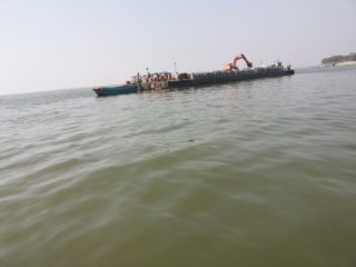
Hydro Graphic Survey
Land Survey Team conducts hydrographic survey with the use of winprofile, hydro pro, surfer and AutoCAD software. Experienced and qualified staff and officials are engaged to conduct survey works efficiently. Some of our completed projects with some sample drawings are given below:
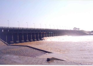
Structural design
Below list details are given in the Structural Design Page
Hydrolic Structure List of BADC,Barisal (2017-18)
Hydraulic Structure List BADC,Jessore(2017-18)
Hydraulic Structure List of BADC,Noakhali(2017-18)
Hydraulic Structure List of BADC,B.Baria(2017-18)
Building Design Lis(2017-18)
Hydraulic Structure List(2017-18)


Geographic Information System
Geographic Information Systems (GIS) is to execute computer applications which have to accomplish database design, development and implementation facilities for GIS in Mapping, Urban Planning, Environmental Impact Analysis, Determine land use/land cover changes, Soil Mapping, Land Information System, Surveying, GIS Applications in Geology, GIS for Planning and Community Development, Collection of Information about Geographic Features etc. utilizing GIS technology.

About us